Discover Cromford – A walk to Cromford Mills, the Wharf and Canal
Walk 4 – A walk to Cromford Mill, the Wharf and Canal
This walk will take about an hour and a half.
Starting from the Market Place, cross over the pedestrian crossing and turn left. You will pass the Old Smithy, now Q Eye, and the Memorial Garden, with its memorial for the 28 men of Cromford who died in the two World Wars. Past the garden Bonsall Brook re-emerges briefly on its way from the pond at the rear of the Greyhound. It disappears under the A6 to reappear at the mill.
At the Crossroads walk straight over via the pedestrian crossing to the Tors Cafe, once a barber’s shop where the writer Alison Uttley had her hair cut as a girl.
Turn right down Mill Lane (also called Mill Road). A few yards along is Grace Cottage, the old gatekeeper’s cottage. The yard here is the site of the First mill. It can be seen to the right beyond the cottage. Opposite the entrance to the yard is the 3 storey workshop built about 1784-5. The smaller brick building with its decorated wooden cornice is known as the Counting House. It has been extensively restored by the Arkwright Society. There is an information board at the entrance to the yard.
Returning to the road, continue towards the mill, passing beneath the site of the cast iron Aqueduct. This was hit by a lorry in 2002 and being of cast shattered into many pieces. There are plans for its restoration. It was built in 1821 to replace an earlier wooden structure carrying water from Cromford Sough to a wheel driving the first mill.
The rear walls of the later mills are to your left. The end of the building is rounded, giving a fortified appearance. Adjacent was the main entrance to the site – an arched gateway set in a brick wall where a fire plate (or plaque) may be seen. This fire plate was stolen between July 16 and 21 2003. In the 18th century fire services were run by insurance companies. Buildings which were insured with them were marked with a plate to ensure that only those properties were visited in the event of fire. The mill buildings continue with a further semi circular extension. These rounded ends were attached to the main buildings to house the stairs and offices.
Opposite is the Mill Manager’s House, and to its left the driveway leading to Rock House, Sir Richard Arkwright’s home. Its position on top of the cliff gave him a clear view of his mills below.
Continue to follow the walls of the mill and enter Cromford Mills part of the Derwent Valley Mills World Heritage Site, and the birthplace of the modern factory system, has recently reintroduced hydroelectric power. The project involves a new water wheel, a 17kW hydro turbine, and a water source heating system, all designed to generate a portion of the site’s electricity and provide heating.
There are guided tours at set times around the site – see the sign or enquire at the Shop In The Yard. Information boards at various points explain the history of the the buildings and watercourses. There is also a permanent exhibition with photographs, models and details of Arkwright’s life and inventions. Books and leaflets are for sale in the shop. This is therefore only a brief view of the site, which has toilets, a restaurant, shops and offices.
Start by walking to the left. Straight ahead you will see the back of the First mill. Originally 5 storeys, the two top floors were destroyed by fire in 1929. It was extended to the right in the mid 1780s, when the mill to the left was also built. The stream which flows through the yard is Bonsall Brook. In the basin is the sluice which channelled the flow of water to the different waterwheels. On the other side of the water course to the right are the foundations of the “Bow Fronted Building” built circa 1790, and used as accommodation barracks for single male workers. It was destroyed by fire in 1961.
Return to the Shop In The Yard. Opposite is the L shaped mill and warehouse erected in 1791. Here, at the top of two flights of stairs, is the Exhibition room. This building was linked at first floor level to Arkwright’s Second mill to its left. The second mill was built in 1776 and was 7 storeys high. It was destroyed by fire in 1890 but its foundations can still be seen along with the wheelpits which housed two waterwheels. The fire also destroyed the upper part of the adjoining wing of the L shaped mill. The other buildings surrounding the yard were built between 1781 and 1791. They were probably warehouses, or workshops for building and maintaining machinery.
Leave the mill site and cross over to the feeder channel to the Cromford canal, the water coming from the sluice in the mill yard. Follow the channel, which leads to Cromford Wharf which veers right past wharf buildings built circa 1794. The first building was the counting house where financial transactions were carried out. To its right is the first warehouse, with an impressive slate covered loading bay over the water. At the end of the building is a crane which you will see from the main canal. Continue along the path to a later warehouse. This dates from about 1824, and was leased by the Wheatcrofts of Cromford. There is a weighbridge here and a canopy over the canal. The castellated end wall still bears the sign: N WHEATCROFT & SON LTD COAL & COKE MERCHANTS
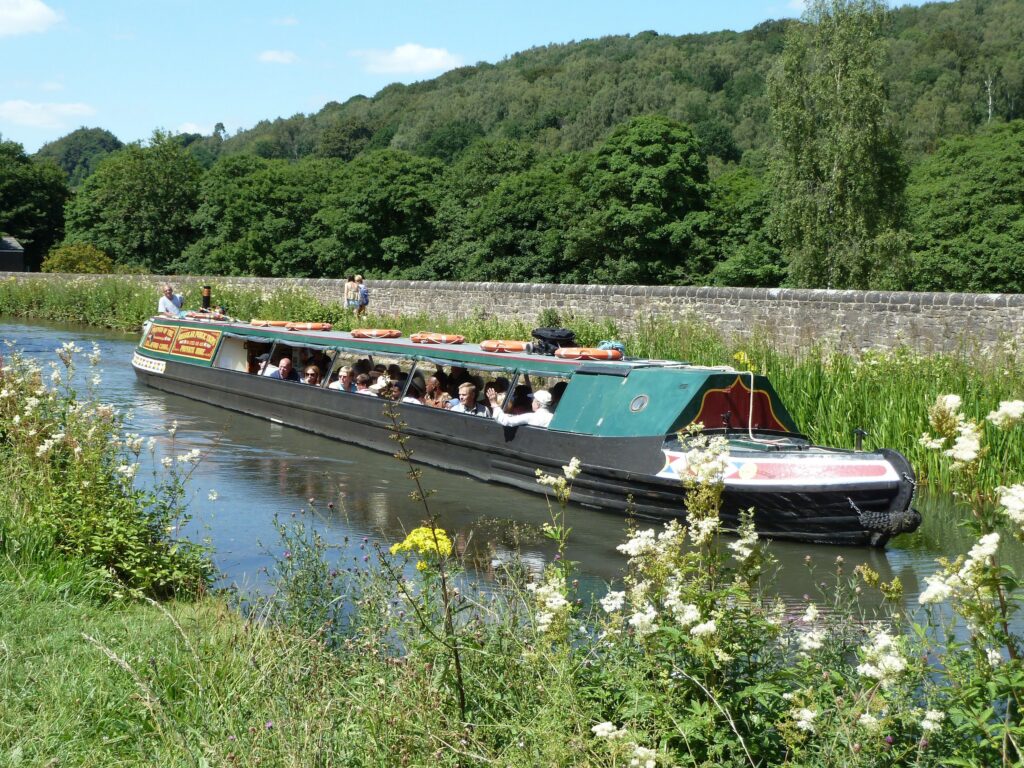
Climb the steps to the right of the warehouse to the start of the Cromford Canal. Opened in 1793, the canal ran for fifteen miles to Langley Mill where it linked with the Erewash Canal. Access to commercial centres such as Liverpool and Nottingham was vastly improved. Cotton fibres, textiles, limestone and lead were all transported on barges, as well as passengers on faster boats. Look across the canal to the rear of the first warehouse – note the upper door for loading carts and the crane attached to the end of the building. Passing under the canopy turn left into the car park area. The two cottages here date from about 1796. To their right was stabling for the canal horses and a smithy, all now gone. Exit on to Mill Lane, and continue to the right as far as the church, which is opposite the entrance to Cromford Meadows. Here return to the Market Place via Church Walk.
To return to the Market Place via Church Walk, cross over to the Parish Church of St Mary. Intended as a private chapel, building was begun by the site of a lead smelting mill. It was finally completed in 1797, five years after his death, and opened for public worship by his son, Richard Arkwright Junior. Originally a plain Georgian building, it was much altered in 1858 by Peter Arkwright. The west front was added and the tower enlarged. Later a handsome clock face was erected, dated AD 1869, but the mechanism dates from 1796. Inside there is an organ gallery. Wall paintings and stained glass windows were added to celebrate the first centenary. Plaques and monuments commemorate the Arkwright family. Sir Richard was buried here after being first interred at Matlock. Other members of the family are buried in the small graveyard by the river, including Frederic who was killed in the First World War.
Leave the church and continue along the path, there is access to the mill site on the left. For a splendid view of Cromford Mill and Willersley Castle follow the path to the left just before the cliff and climb the steps to the top of Scarthin Tor. It is fenced at the top but care should be taken. Return to the path and continue to follow the track at the foot of the cliffs by the River Derwent. These cliffs are a favourite spot for rock climbers. This track, known locally as Church Walk, was a private driveway made for the use of the Arkwright family, and followed the line of an old pathway. It emerges through cast iron gates set between stone gateposts on to the A6. A gatehouse once stood here tucked under the cliff face.
To see Masson Mill, turn right, it is a short walk along the main road following the river, with Willersley Castle set on the hillside above. The middle section of this redbrick mill was built by Sir Richard Arkwright in 1783/4, and was the only Cromford mill to be powered by the river. The chimney and buildings at the north and south sides were built later by English Sewing Ltd, who bought the mill from Frederick Arkwright in 1898. Further north is the site of a paper mill built in 1768, still in production in the second half of the 19th century. On the river above the mill is a convex weir built to direct water to the waterwheels, these were replaced by turbines in the 1920s.
In 1991 when the mill closed it employed 750 people and was the oldest working mill in the world. Masson Mill is producing hydroelectric power today. The mill utilises the River Derwent for its power generation, with hydroelectric turbines producing renewable energy. The site is still powered by the river, and any surplus energy is fed into the National Grid. The mill is now home to a textile museum and cafe and conference rooms. Return to Cromford along the main road. Just past the gates from Church Walk the road passes beneath Scarthin Tor. This huge rock originally continued across the road, effectively cutting Cromford off from Matlock Bath except by foot. Arkwright had a narrow passageway blasted through the rock. It was widened in 1816-18 when the turnpike road to Belper was constructed (later the A6), and widened again in the early 1960s. Continue over the crossing by Tors Cafe to the Market Place.